PROFESSIONAL DRONE SERVICES

Professional UAV Drone Services for Residential, Commercial, Surveying & Photogrammetry

FULLY INSURED- FAA APPROVED

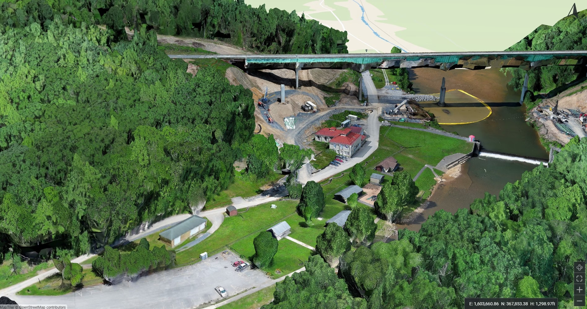
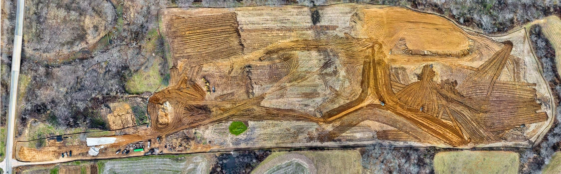
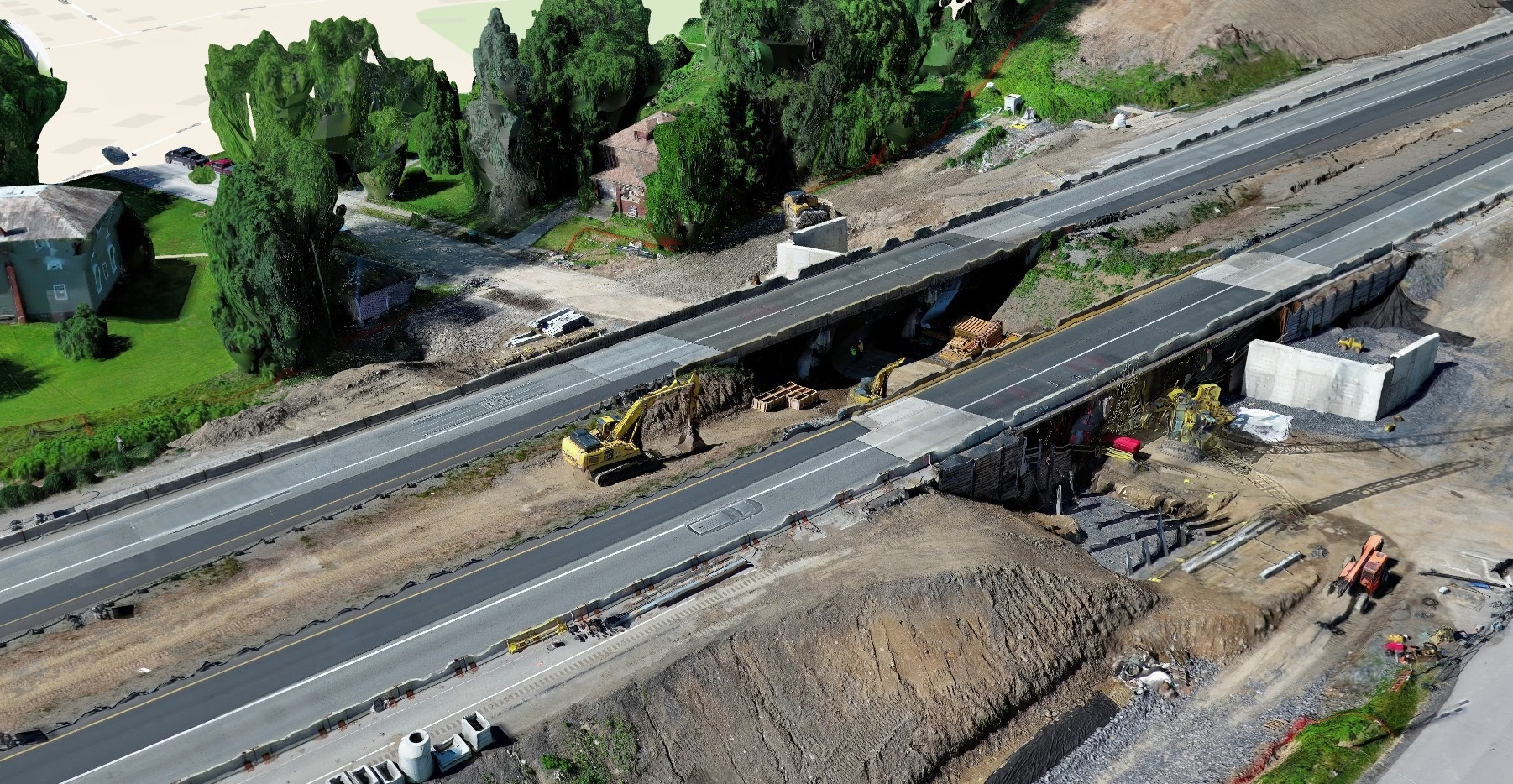
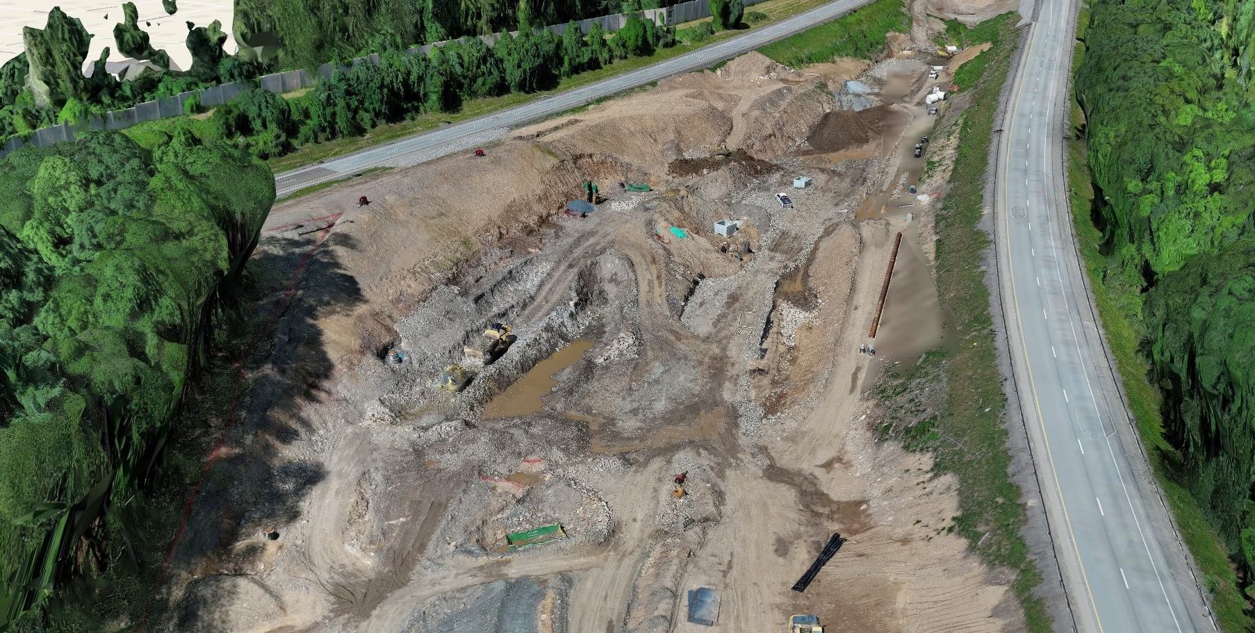
Drone data collection

Experience the future of aerial solutions with our comprehensive drone services! Whether it’s residential, commercial, or construction projects, our state-of-the-art drones deliver unparalleled quality and precision. Capture stunning visuals, monitor progress, and ensure safety from a bird’s-eye view. Trust us to elevate your project to new heights with cutting-edge technology and exceptional service.

📊 Why Choose Us

  • FAA-certified drone pilots
  • High-resolution 4K and 6k camera drones
  • Fast turnaround and secure data delivery
  • Custom flight plans for every project

Industries We Serve

Residential Inspections
Elevate your property’s appeal with our professional residential drone services. We capture breathtaking high-resolution photos and videos, perfect for real estate listings, insurance assessments, or simply showcasing the beauty of your home.
Commercial Inspections

Our commercial drone services provide comprehensive aerial inspections and assessments for your building. From roof inspections to facade analysis, we deliver high-resolution imagery and data, helping you identify potential issues, plan maintenance, and improve safety. Save time, reduce costs, and ensure the longevity of your building with our efficient and cost-effective drone solutions. We provide detailed reports and 3D models for thorough analysis. Elevate your building management with our advanced drone technology.

Construction QC flights
We offer high-resolution aerial photography and videography for construction progress monitoring, infrastructure inspections, land surveying, and more. Our experienced and fully licensed pilots utilize advanced drone technology to deliver precise, reliable data, helping you make informed decisions and optimize your operations.
Photogrammetry & Orthomosaic

Transform your data acquisition with our cutting-edge drone photogrammetry services. We utilize advanced drone technology and sophisticated software to create highly accurate 3D models, orthomosaics, and digital elevation models (DEMs) from aerial imagery. Ideal for surveying, construction, mining, and more, our services deliver precise, cost-effective solutions for a wide range of applications. Contact us to learn how we can elevate your project with unparalleled accuracy and detail.

Let us know about your drone needs.